The American Eagle

Tied by "Gumbo". Photo by Matt Pederson.

 .
.
|
The information on this page is gathered hourly from government operated web sites and cached locally on the web server at http://www.elilabs.com for faster and more convenient viewing. The cache was last updated at Tue Jun 9 12:17:58 AM EDT 2026. Because of this caching, this information may not always be the very latest that is available. To see the original web page from which a peice of information was obtained, click on the asterisk following the title of the graph or report, and you will be taken to the original page. This page will automatically refresh every 20 minutes. Last refresh was at 00:26 EDT . Read our privacy statement. |

|
|

|

|
|

|
|
|
|
|
|
Sunrise and sunset are calculated by the today program. Moon phase is calculated
by this ugly hack.
This textual summary report is available by itself for
those who just want the
quick facts.
|
|
|
|
|
|

|
|
|

|
| 24 Hr Forecast Rainfall/Pressure * |

|
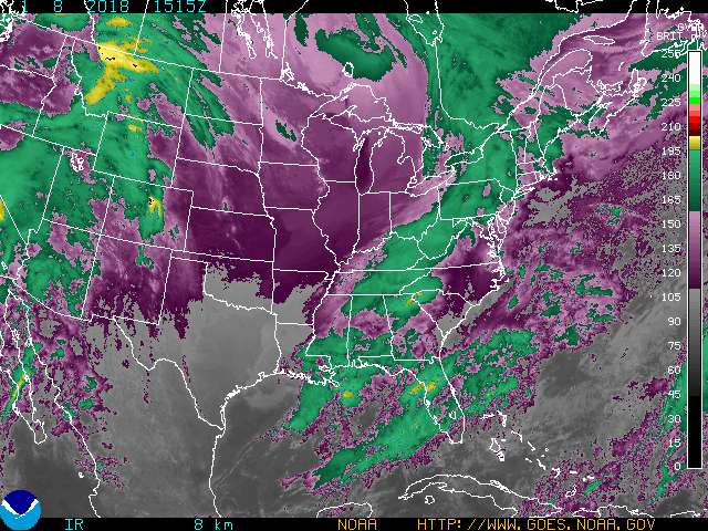
| GOES 8 Eastern US SECTOR Infrared Image * |
|
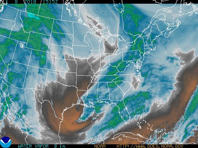
| GOES 8 Eastern US SECTOR Water Vapor Image * |
|
| 24 Hr Forecast Temp/Wind * |

|
|
|
This map was last updated on
Tue Jun 9 00:00:00 EDT 2026
.
Cloud cover (black areas) prevents the satellites from seeing the lake surface.
|
|
 If you know of any way to get
river
water temperatures
off the internet, please tell
Gumbo.
If you know of any way to get
river
water temperatures
off the internet, please tell
Gumbo.

| Lake Level at Milwaukee * |
|
|
| WI DNR Root River Report * |
See also the description of the Root River Steelhead Facility.
|
|
| Milwaukee River Flow * |
|
|
| Oak Creek Flow * |
|
|
| Root River Flow * |
|
|
| Pike River Flow * |
|
|
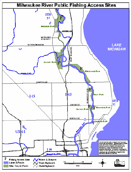
| Milwaukee River Map * |
|
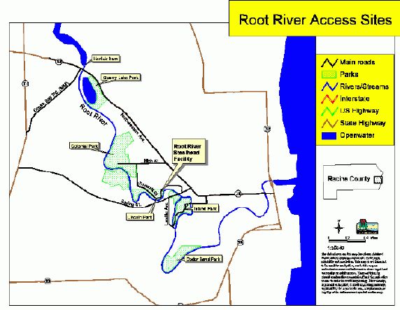
| Root River Map * |
Check out the Fatman's excellent map also.
|
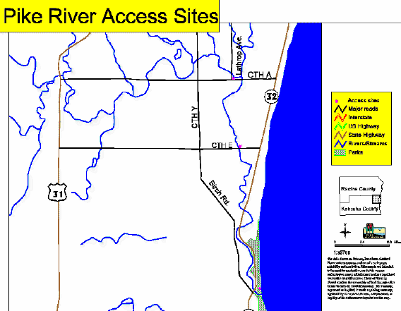
| Pike River Map * |
|
|
|